Fire Information Sites
NIFC
NIFC Situation Report
National Interagency Coordination Center
US Forest Service Fire News
Wildland Fire Assessment System
USDA Forest Service Fire & Aviation Management
National Wildfire Coordination Group
National Fire Plan
National Center for Landscape Fire Analysis
Fire Weather and Reports
NOAA Fire Weather
Western Regional Climate Center
National Weather Service Fire Weather
Federal Fire Agencies
US Forest Service
Bureau of Land Management
US Fish and Wildlife Service
National Park Service
Bureau of Indian Affairs
National Weather Service
Office of Aircraft Services
Fire Maps & Images Large Fire Location Map Excellent map that shows all large fires currently burning in the USA and Canada...
Fire Maps & Images
Large Fire Location Map
US Forest Service Remote Sensing Application Center MODIS Fire Maps
NASA MODIS Rapid Response System
University Maryland MODIS Rapid Response
National Fire Maps GEOMAC
US Forest Service AVHRR Fire Images
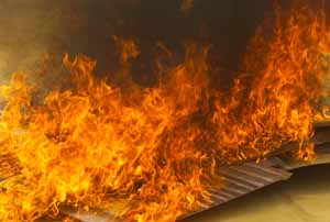
Wildfire Pictures
Get a job now! 1000s of New Jobs Here Now!
*** Click on any Job to see new job listings:
FIRE101 Jobs
Firemen, Volunteer FD,
EMT, EMS, Emergency,
Firefighters, Chief, Rescue
POLICE101 Jobs
Police Officers, Security
Law Enforcement, Cops
Forensics, Investigation
Legal, Lawyer, Intern Jobs
Lawyers, Attorneys
Prosecutor, District Attorney
Paralegals, Intern Jobs
Finance Jobs, Banking Accounting, Insurance Investment Banking, Equities Corporate Finance, Interns
Finance Jobs, Banking
Accounting, Insurance
Investment Banking, Equities
Corporate Finance, Interns
Mainframes Jobs, IT, MIS
z/OS, DB2, CICS, ECM
COBOL, Assembler,
z Systems Programmers
Project Managers,
QA, Customer Support
GENETICS101 Jobs
Lab Techs, Interns,
Gene Research, Medical
Genomes, Biotech
Software101 Jobs
JAVA, .NET, C++, C#
HTML, PHP, SQL, Linux
Nursing101 Jobs
Clinical, Emergency, ICU
LPN, RN, Travel, Home
*Z101* FIRE101 Police101 Obituaries101 SchoolDirections
Geographic Coordination Centers
Alaska Center
Northwest Center
California North Center
California South Center
Great Basin West Center
Great Basin East Center
Southwest Center
Northern Rockies Center
Rocky Mountain Center
Southern Center
Eastern Center
Fire Equipment and Gear
Fire Rescue Information
Hazmat and Chemical Information
Copyright © 2006-2008 FIRE101.COM
 Get a
job now! 1000s of
New Jobs Here Now!
Get a
job now! 1000s of
New Jobs Here Now!